SeaMarks by Andren Software Co.
Manage your fishing or diving hot spots.
Features
• Manage your waypoints, routes and tracks on the computer.
• Import waypoints, routes and tracks from a variety of GPSs
• Export waypoints and routes to a variety of GPSs.
• Convert Loran readings to GPS waypoints
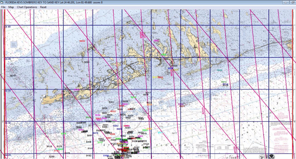
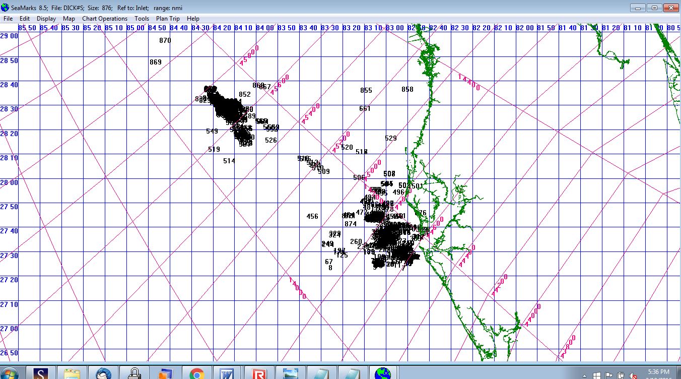
• Print your book with spreadsheet listings and charts.
• Coordinate your book with your GPS track plotter
• Import or export a large variety of data file formats for compatibility with other programs.
• Convert waypoints and routes from one GPS format to another.
• Display your points in a variety of formats
• Identify waypoints with Name, Description, Rating, Color, Icon, Depth, Group, Date, and Comments
• Accept and display GPS Lat/Lon in a variety of formats.
• Color the waypoints on listings and/or graphics.
• Sort your waypoints numerically or alphabetically on any column• Display your list in pre-formatted or user customized spreadsheet styles and find duplicates.
• Group your waypoints to make it easier to find them in your GPS.

Company History
Carl Andren, the creator of this program, is a member of the Institute of Navigation, the International Loran Association, and the Institute of Electrical and Electronic Engineers. He holds 26 patents in electronics including some on the technology known as WiFi.
The program has been re-branded several times to follow the progression of technology. It started out as The Loran Program when Loran was the only means of electronic navigation. When GPS came along and began to make inroads, the name was changed to The Loran/GPS Program. Later that was shortened to LoranGPS. Now that GPS is the only thing used by fishermen, the Loran-centric name was changed to SeaMarks (think wet landmarks).
Version Updates
2/27/24
Made some minor updates
12/19/23
Fixed PCWindPlot import algorithm . Also made sure the program was "signed"
!0/13/23
Fixed the Replace function which had Color and Symbol swapped
7/3/23
Made improvements to import routines for Humminbird HWR and Garmin GDB that are for very old models. Also made changes to the Furuno NavNet3D importer.
5/31/22
Made small improvements like warning messages.
2/22/22
Fixed issues with importing a Furuno GP1971F file causing an overflow error and the Fish32N tracks importer that had spurious .points.
2/2/22
Fixed the Export of Raymarine GPX format that was getting dates wrong.
1/22/22
Added import for an Italian track plotter named Fish32N.
12/2/21
Added Furuno TZD and FurunoGPX to the import form GPS definition so as to load the appropriate icons. Made a new Garmin GDB importer that does not use GPSbabel. Fixed an issue where Symbol and Color were swapped in the Finder list so that they did not work right.
See History for a list of all the updates since version 2.3
5/13/19 Big change! We switched to a virtualized mode for the program. This involves combining all functions, resources, and libraries into one executable (boxed app) that does not have to be "Installed". Thus, the program can run on a removable disk (flash drive) as well as the usual location on the hard drive. As for the hard drive, we supply a simple 'installer' that creates a place (folder) for the program on the hard drive, copies the program there, and creates shortcuts. While the experienced customer could do this, many of our customers are not comfortable with these operations. The version is now 10.2 and if ordered on the USB flash drive, you can run it there immediately if you don't want to put it on the hard drive..
The program has been maintained and improved frequently. If you have an older version, check with the Change History page to see details on the changes in the program since your version was shipped. The version number is not incremented for small changes, only large ones.